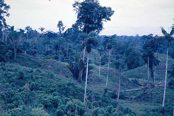
Ferralsols occur in tropical and subtropical regions of the world, mainly on old and stable land surfaces.
Characteristics
Soils having a ferralic horizon (strongly weathered horizon with low-activity clays and very low amounts of weatherable minerals) between 25 and 200 cm from the soil surface. They lack a nitic horizon (a horizon with strongly developed, nut-shaped structure) and do not have a layer which fulfils the requirements of an argic horizon and which has, in the upper 30 cm, 10 percent or more water-dispersible clay.
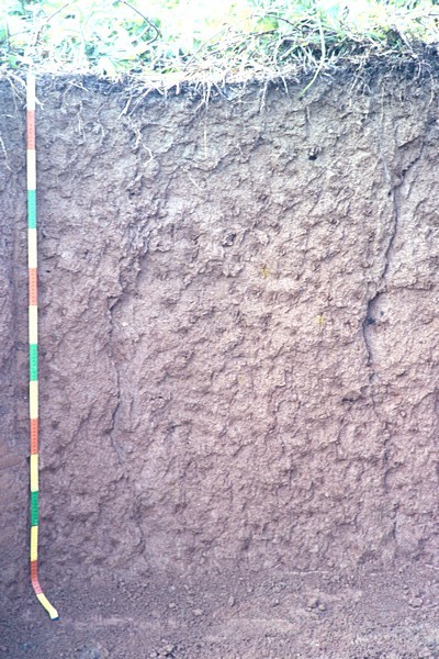
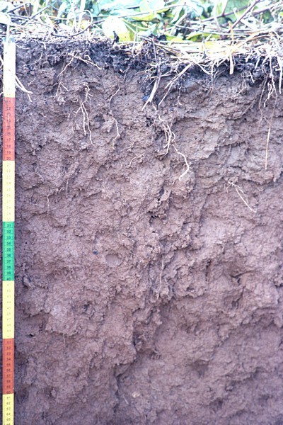
Reference soil EC006: Ferralsols
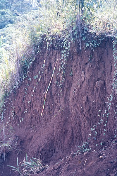
Road cut observations show different (completely weathered) parent materials like conglomerate, clay(stone?),.. The subsoil shows a weak yellowish mottling probably due to redox processes. The soil shows clear narrow cracks when dry. The soil is well structured which agrees with the classification as Nitosol. If the morphology is not taken into account it will come out as ferric Acrisol.
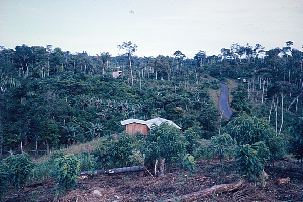
| Location | Napo, Francisco de Orellana, 12km S of Coca |
| Köppen | Af |
| Authors | Kauffman JH & G Del Posso |
| Date | 1987-05-01 |
| Lat/Lon | -0.5167, -76.9333 |
EC006

| General characterization of the status of weathering of solid rock | highly |
| Mode of accumulation or deposition of parent material | residual material |
| Kind 1 (parent material) ; Parker (eds), 1984 | conglomerate |
| Weathering Resistance | moderate |
| Texture of parent material | clayey |
| Remarks on Parent Materials | Tertiary clay/conglomerate |
| Soil Depth | 300cm |
| Topography; Guidelines for soil description - Fourth edition (FAO, Rome, 2006) | hilly |
| Form of the slope surrounding the site | convex |
| Physiographic Unit | interfluve "colina" |
| Altitude | 250m |
| Slope | 25% |
| Physiographic position of the site | middle slope |
| Regional landform; McDonald, R.C., Isbell, R.F. et all, 1984; Australian soil and land survey Field Handbook, Inkata Press, Melbourne. | low hill |
| Drainage class ; FAO (2006) - Guidelines for soil description | well |
| Flooding frequency (FAO, 1986) | never |
| Kind of ground water table (USDA, 1979) | no groundwater table observed |
| Estimated permeability (class) of least permeable part of the profile | moderate |
| Estimated run off (class) | rapid |
| Moist From - To | 0-300cm |
| Soil erosion type | sheet |
| Intensity of the soil erosion type | slight |
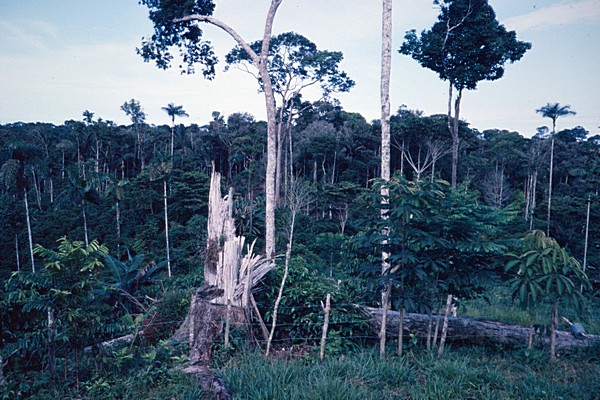
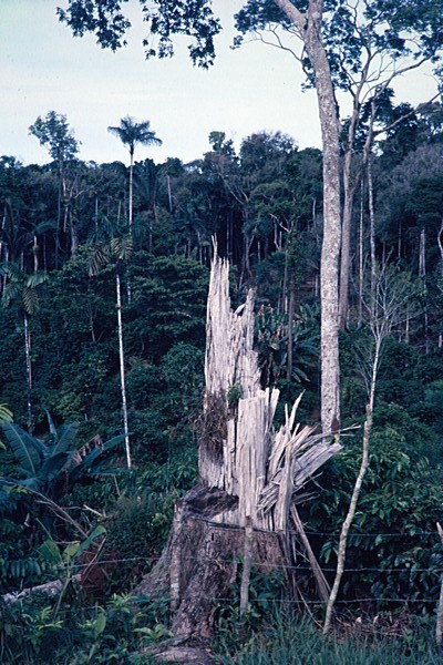
| Major vegetation type; Guidelines for soil description - Fourth edition (FAO, Rome, 2006) | evergreen forest |
| Rotation scheme ; Guidelines for soil description - Fourth edition (FAO, Rome, 2006) | crop rotation scheme not relevant |
| Major crops | coffee |
| Remarks on Land Use / Vegetation | VEGETATION: LANDUSE: Recently cleared land; coffee is main crop |
| Land use or vegetation in the immediate vicinity of the site | low level arable farming |
| Land improvements ; Guidelines for soil description - Fourth edition (FAO, Rome, 2006) | no land improvement |
| Evidence of salt; Soil Survey Manual USDA, 1951 | non-saline |
| Evidence of alkali ; Soil Survey Manual USDA, 1951 | non-alkaline |
| Rock outcrop class (FAO (2006) - Guidelines for soil description) | none |
| Surface stoniness class (FAO (2006) - Guidelines for soil description) | none |
| Slaking of aggregates by tillage, rainfall or frost (USDA/SCS, 1979) | no surface slaking/crusting observed |
| Surface cracking | small cracks (width less than 1 cm, or depth less than 50 cm) |
WRB 2006
| Vetic Acric Ferralsols (Alumic Clayic ) |
| 20-150 | argic horizon |
| 18-150 | ferralic horizon |
WRB 1998
| Acric Veti Alumic Ferralsols |
| 18-150 cm | ferralic horizon |
| 20-150 cm | argic horizon |
| 0-18 cm | ochric horizon |
FAO-UNESCO-ISRIC 1974
| Dystric Nitosols |
| - | ferric horizon |
| 0-42 cm | ochric A horizon |
| 20-150 cm | argillic B horizon |
Local classification
| Classification information | Suelo Rojo |
| USDA-SCS (1975) | Paleudult perudic clayey isohyperthermic |
| Description of a site | Road cut observations show different (completely weathered) parent materials like conglomerate, clay(stone?),.. The subsoil shows a weak yellowish mottling probably due to redox processes. The soil shows clear narrow cracks when dry. The soil is well structured which agrees with the classification as Nitosol. If the morphology is not taken into account it will come out as ferric Acrisol. |
Climate data
| Description | record | Jan | Feb | Mar | Apr | May | Jun | Jul | Aug | Sep | Oct | Nov | Dec | Annual |
|---|---|---|---|---|---|---|---|---|---|---|---|---|---|---|
| Bright sunshine (hours/day) | 999 | 4 | 3.1 | 2.6 | 3.2 | 2.4 | 2.2 | 2.7 | 3 | 2.6 | 3.8 | 3.8 | 3.7 | 3.1 |
| Epot. - Penman (mm) | 4 | 72 | 61 | 65 | 55 | 54 | 59 | 60 | 67 | 63 | 76 | 70 | 81 | 783 |
| Mean temperature (°C) | 999 | 26.1 | 26 | 25.9 | 25.4 | 25.2 | 24.8 | 24.3 | 25.2 | 25.4 | 25.3 | 25.5 | 25.4 | 25.4 |
| Precipitation (mm) | 999 | 196 | 322 | 190 | 368 | 270 | 252 | 205 | 170 | 280 | 356 | 350 | 256 | 3215 |
| Relative humidity (%) | 999 | 91 | 90 | 90 | 90 | 91 | 92 | 91 | 91 | 93 | 90 | 89 | 89 | 90.6 |
| Windspeed (m/s, at 2m height) | 999 | 0.5 | 0.6 | 0.5 | 0.4 | 0.4 | 0.4 | 0.5 | 0.5 | 0.5 | 0.5 | 0.5 | 0.6 | 0.5 |
| Station: | El Coca |
| Country: | Ecuador |
| WMO Code: | 99.999 |
| Altitude: | 0 |
| Latitude/Longitude | S0°29 W76°59 |
| Ah 0-18 cm | dark yellowish brown (10YR 3/6, moist)clay,moderate fine and medium subangular blocky,friable sticky plastic,many few medium continuous inped tubular random pores,gradual smooth boundary to, |
| AB 18-42 cm | dark yellowish brown (10YR 4/6, moist)clay,moderate fine and medium subangular blocky and moderate fine and medium wedge-shaped angular blocky,friable sticky plastic,broken moderately thick clay cutans,many few medium continuous inped tubular random pores,very few pebbles fragments,gradual smooth boundary to, |
| Bt 42-75 cm | yellowish red (5YR 5/6, moist)clay,moderate fine and medium subangular blocky and moderate fine and medium wedge-shaped angular blocky,friable sticky plastic,continuous moderately thick clay cutans,many very fine continuous inped tubular random pores,very few pebbles fragments,diffuse smooth boundary to, |
| Bg 75-150 cm | red (2.5YR 4/8, moist)clay,moderate medium and coarse subangular blocky and moderate medium and coarse wedge-shaped angular blocky,friable sticky plastic,common fine distinct diffuse mottles (10 YR 6/6),continuous moderately thick clay cutans,common very fine continuous inped tubular random pores,very few pebbles fragments, |
| Depth (cm) | C % weight/weight | Ca cmol(c)/kg | CaCO3 % weight/weight | C / N unitless | EC 1: 2.5 mS/cm | Exch. Acid cmol(c)/kg | Exch. Al cmol(c)/kg | K cmol(c)/kg | Mg cmol(c)/kg | N % | Na cmol(c)/kg | pH H2O unitless | pHKCl unitless | Sum Cations cmol(c)/kg |
| 0-18 | 1.79 | 2.3 | - | 10 | 0.16 | 1.4 | 1.1 | 0.5 | 1.1 | 0.18 | 0.0 | 4.9 | 4.0 | 3.9 |
| 18-42 | 0.81 | 0.2 | - | 10 | 0.03 | 3.6 | 3.7 | 0.0 | 0.1 | 0.08 | 0.0 | 4.9 | 3.9 | 0.3 |
| 42-65 | 0.53 | 0.2 | - | 8 | 0.02 | 3.1 | 3.2 | 0.0 | 0.1 | 0.07 | 0.0 | 4.7 | 3.8 | 0.3 |
| 65-150 | 0.31 | 0.0 | - | 8 | 0.02 | 2.2 | 2.1 | 0.1 | 0.1 | 0.04 | 0.0 | 4.8 | 3.9 | 0.2 |
| Depth (cm) | Al sat. % | Base sat. % | CEC clay cmol(c)/kg | CEC org cmol(c)/kg | CEC soil cmol(c)/kg | ECEC cmol(c)/kg | ESP % |
| 0-18 | 13 | 46 | 12 | 6.3 | 8.4 | - | 0 |
| 18-42 | 57 | 5 | 8 | 2.8 | 6.5 | - | 0 |
| 42-65 | 54 | 5 | 7 | 1.8 | 5.9 | - | 0 |
| 65-150 | 31 | 3 | 8 | 1.1 | 6.8 | - | 0 |
| Depth (cm) | Al d % weight/weight | Al o % weight/weight | Al p % weight/weight | C p % weight/weight | Fe d % weight/weight | Fe o % weight/weight | Fe p % weight/weight | ODOE unitless | pH NaF unitless | P Retention % | Si o % weight/weight |
| 0-18 | 0.70 | 0.20 | - | - | 4.20 | 0.40 | - | - | 8.3 | 38 | 0.00 |
| 18-42 | 0.80 | 0.20 | - | - | 5.10 | 0.10 | - | - | 8.6 | 40 | 0.00 |
| 42-65 | 0.90 | 0.20 | - | - | 5.70 | 0.10 | - | - | 8.8 | 45 | 0.00 |
| 65-150 | 0.80 | 0.20 | - | - | 5.60 | 0.10 | - | - | 9.1 | 50 | 0.00 |
Particle size distribution
| Depth (cm) | Clay % weight/weight | coarse sand % weight/weight | coarse silt % weight/weight | fine sand % weight/weight | fine silt % weight/weight | Gravel % volume/volume | medium sand % weight/weight | Total sand % weight/weight | Total silt % weight/weight | very coarse sand % weight/weight | very fine sand % weight/weight |
| 0-18 | 70.3 | 1.4 | 5.9 | 1.8 | 15.8 | 0 | 1.7 | 8.1 | 21.7 | 1.0 | 2.2 |
| 18-42 | 77.3 | 1.5 | 2.9 | 1.5 | 13.3 | 0 | 1.3 | 6.7 | 16.2 | 0.7 | 1.7 |
| 42-65 | 84.8 | 1.1 | 2.2 | 1.1 | 8.4 | 0 | 0.9 | 4.6 | 10.6 | 0.4 | 1.1 |
| 65-150 | 87.3 | 0.7 | 1.3 | 0.7 | 8.5 | 0 | 0.6 | 2.9 | 9.8 | 0.2 | 0.7 |
Other physical data
| Depth (cm) | Bulk density kg/dm³ | Clay % weight/weight | COLE cm/cm | Spec. Surf. Area m²/g | Water disp. clay % |
| 0-18 | - | 70.3 | - | - | 21.2 |
| 5-10 | 1.010 | - | - | - | - |
| 18-42 | - | 77.3 | - | - | 0.0 |
| 50-55 | 1.010 | - | - | - | - |
| 100-105 | 0.990 | - | - | - | - |
| 42-65 | - | 84.8 | - | - | 0.0 |
| 65-150 | - | 87.3 | - | - | 0.0 |
Water retention characteristics
| Depth (cm) | Bulk density kg/dm³ | pF 0 % volume/volume | pF 1.0 % volume/volume | pF 1.5 % volume/volume | pF 2.0 % volume/volume | pF 2.3 % volume/volume | pF 2.7 % volume/volume | pF 3.4 % volume/volume | pF 4.2 % volume/volume |
| 5-10 | 1.010 | 57.5 | 55.7 | 51.0 | 47.0 | 45.0 | 42.1 | 34.6 | 31.7 |
| 50-55 | 1.010 | 61.1 | 60.5 | 56.3 | 54.9 | 54.2 | 53.2 | 40.0 | 36.6 |
| 100-105 | 0.990 | 60.0 | 59.6 | 56.6 | 54.6 | 53.5 | 52.3 | 42.2 | 37.6 |
| Depth (cm) | Chlorite unitless | Feldspar unitless | Gibbsite unitless | Goethite unitless | Halloysite unitless | Hematite unitless | Kaolinite unitless | Mica / illite unitless | Mixed-layer unitless | Quartz unitless | Smec unitless | Vermiculite unitless |
| 0-18 | - | - | - | medium to strong | - | - | very strong | - | weak | - | - | - |
| 18-42 | - | - | - | medium to strong | - | - | very strong | - | weak | - | - | - |
| 42-65 | - | - | - | medium to strong | - | - | very strong | - | weak | - | - | - |
| 65-150 | - | - | - | medium to strong | - | - | very strong | - | weak | - | - | - |